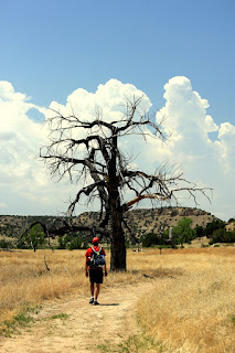
 Not much has been written about the plains east of Colorado's Rocky Mountains. At first glance, it looks pretty flat and boring. But if you look close enough on Google Maps, you'll find some patches of land worth exploring. That's how we found Comanche National Grassland in southeastern Colorado.
Comanche National Grassland is divided into two units: the Timpas unit is south of La Junta, and the Carrizo unit is south of Springfield. Patches of government-owned and private land co-exist in these areas.
From La Junta to Timpas, it is a 30-minute drive through rocky, unpaved roads, flat grasslands and prairies with the occasional gentle rolling hills. It definitely felt like we were in the "middle of nowhere." I recommend a 4WD vehicle, for sure.
 After a bumpy ride, we pulled into the campground that overlooked Picketwire Canyon. My first impression was that it's quite beautiful - in a desolate kind of way.
Hiking in this terrain is not for the faint of heart in the middle of the summer. The Picketwire Trail begins with a steep hike down into the canyon. You have to navigate slowly over rock piles. The trail itself is relatively flat with the occasional hill to overcome, but it's incredibly dry. The ground was cracked and thirsty. The trees were barren, so there was zero shade.
There is an accessible water source, but the rangers advised against it because it's heavily used by nearby cattle. So under the beating sun, each of us carried around 12 pounds of water on our backs. To lighten our load, we left a water cache for the return hike.
There are some wildlife viewing opportunities. We saw a jackrabbit, lizards and some type of deer. There are rattlesnakes in this area, but we did not encounter any. The rangers said they keep pretty much to themselves.
In the canyon, there are ruins of an old Mexican mission and settlement, a cemetery, Native American rock art, a historic ranch, and dinosaur tracks.
On the banks of the Purgatoire River are over 1,300 dinosaur tracks, created over 150 million years ago. The tracks show the brontosaurus/apatosaurus and allosaurus traveling in herds. I had no idea such an important discovery could be found in such a relatively obscure location.
The return trip was not easy, especially in 98°F, but the afternoon breeze helped alleviate the dry heat. That last stretch over the rock piles was brutal.
The wonderful thing about this place is that it is remote. We had the campground pretty much to ourselves.
As dusk approached, strong winds howled and whipped through our campsite. But once the winds subsided, we enjoyed a clear, star-filled summer sky.
Note: There are plenty of articles on the dinosaur tracks, but not much on Comanche National Grassland as a destination itself. But the Visit La Junta and Explore Southeast Colorado websites convinced us it was worth going!
